GPS Buff Up: GEO-Mapping with Google Earth
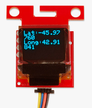
We added a follow-up GPS tutorial to increase your GPS skills a few weeks ago. Now we want to show you a practical example with a handheld GPS coordinate logger that will pin locations for your viewing pleasure using Google Earth.
GPS is one of my favorite nerd subjects, closely followed by anything relating to rocket propulsion. So naturally, I had to dive deeper than our GPS beginner's tutorial. We did some brainstorming on how to take the next step with GPS - once you have a latitude and longitude, you could go ten ways from Sunday with it!
However, instead of delving into the multitude of projects we would like to work on, we asked: How would an everyday person most commonly interact with GPS technology on a day-to-day basis?
The first thought we had was, "What about Google Maps?" Navigation using a GPS system from your mobile device or web browser is an interface that nearly everyone should have some experience with. Much to the delight of GPS enthusiasts or globe groupies, Google Earth gives you the cosmic viewing power of our earth right on the screen. It has tons of features, including geo-mapping capabilities using KML files.
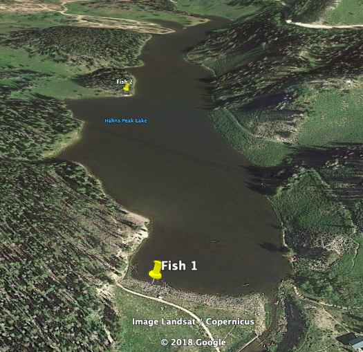
What is a KML file, you might ask? It stands for Keyhole Markup Language and yes, it is similar to HTML (Hyper-Text Markup Language). This format allows us to easily organize our data (altitude, location, atmospheric data, etc.) for Google Earth. There are a lot of functions supported, but we’ll use the placement tool. When your location is loaded into Google Earth, a graphical pin is dropped wherever you are. This is not only a useful feature for knowing where you are in the world and how to get to other places, but you can use your data to log locations of the best hiking trail, the coolest bird watching perch, or the nicest coffee shop in town.
GPS Geo-Mapping at the Push of a Button
I thought this would be very handy for me as a fisherman. I'm far from having the skills of a professional, but it is one of my favorite hobbies. I’m always on the hunt for the best fishing spot near my home. Luckily for me, there are many lakes and ponds that have potential. The problem is, how do I know which fishing spot is the best?
In our first tutorial, I thought it would be handy to create a system where you can push a button and write down the coordinates to log your catches. Perhaps with enough data, I could find the prime fishing spots at my favorite lake. However, using the tools from Google Earth, I can easily push a button and get right back to fishing without the delay of writing everything down!
With enough data and fish caught, I can easily picture myself fishing the day away at the most relaxing, fish-packed lake near my home.
Whatever your position, GPS is a fun and useful tool that's widely available to the public. Whether you're casting out a lure or just strolling through a park, put the power of the globe in the palm of your hand today!
Ready to get hands-on with GPS?
We've got a page just for you! We'll walk you through the basics of how GPS works, the hardware needed, and project tutorials to get you started.
