So Close. But Exactly How Close?
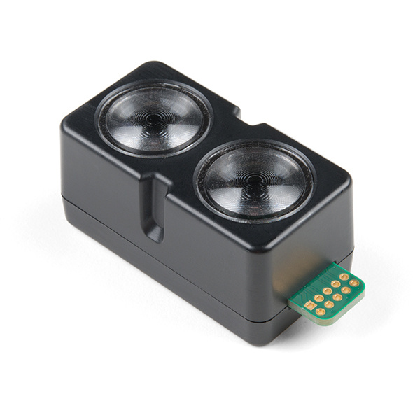
When it comes to proximity and distance sensing, LiDAR has a lot to offer. With Garmin's LiDAR-Lite v4, there are some new features and advances you're definitely going to want to see.
There are many reasons why we might need to measure distance or proximity in a project. Obstacle avoidance jumps to mind, of course, but perhaps we want a UAV to maintain a constant elevation over changing terrain. Maybe you want to scan part of a 2000-year-old European castle to create a 3D representation of it. For many applications, LiDAR - Light Detection And Ranging - is the perfect solution. But like everything, it does have potential drawbacks. LiDAR units can be expensive, draw high current and, let’s face it, they shoot lasers. Carelessness could easily lead to a sudden loss of depth perception.
With the release of the new LiDAR-Lite v4, Garmin has addressed some of those issues and added some great new features, too.
One of the cool additions to this version of the LiDAR-Lite is its support for Ultra Low Power (ULP) wireless technologies, including ANT and Bluetooth® 5 LE. ANT can be used to transmit data to a computer or microcontroller as it comes in, while the BLE is for updating the device's software wirelessly. ANT is an ultra-low-power wireless network protocol that can handle peer-to-peer, star, tree and mesh topologies. If you’re not familiar with the ANT wireless protocol, you can get a good idea of the basics here. For a complete look at everything the Garmin LiDAR-Lite v4 is capable of, check out their Operation Manual and Technical Specifications sheet.
Happy hacking!
Interested in learning more about distance sensing?
Learn all about the different technologies distance sensors use and which products would work best for your next project.
Take me there!
